|
5.23.12 Press Release
Even with a 'monsoon storm' an hour before the start, the Moonshine & Mountains fundraiser in Asheville was a lovely event! Troy & Sons created the ultimate cozy & inviting atmosphere. The food from Corner Kitchen was marvelous. The music from Screech Owl Serenade complemented the event in a perfect way! Thanks to all who helped & everyone who attended!! We're looking forward to next year's event already!
5.5.12 Press Release
The Southeast Regional Land Conservancy (https://serlc.org/) is celebrating its 10th anniversary of protecting nature around the southeastern United States. Regional Land Conservancy, Inc. is a non-profit, charitable organization dedicated to protecting our natural resources through conservation easements. Since our founding in 2002, we have protected over thirteen thousand acres in projects from the Alabama Ridge & Valley, Georgia piedmont, South Carolina sandhills, to the coast and high mountains of North Carolina. Through these easements we have protected important wetlands, mountain coves and ridges, piedmont forests, stream banks, mountain views, and open spaces. Much work remains to be done. We invite all who care about the future of our region to help us protect our natural resources for future generations.
4.2.12 Press Release
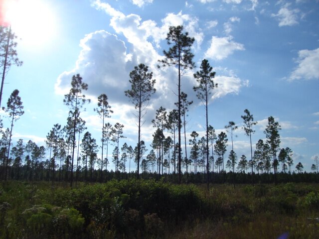
 Situated in the inner Coastal Plain, the Sage Valley easements are within the northern edge of the Fall-line Sandhills. This geologic formation is quite limited and supports very unique habitats. The cumulative easements now protect three thousand nine hundred sixty-three (3963) acres. Continuity, such as afforded this large land area, is an important ecological concept for sustainable habitat for plant and animal species. Habitat value is enhanced exponentially when connectivity occurs because habitat potential and diversity is increased. Large land area means that the species within can maintain better genetic diversity and have larger foraging/nesting habitats. The easement area supports rare species and important natural communities. Situated in the inner Coastal Plain, the Sage Valley easements are within the northern edge of the Fall-line Sandhills. This geologic formation is quite limited and supports very unique habitats. The cumulative easements now protect three thousand nine hundred sixty-three (3963) acres. Continuity, such as afforded this large land area, is an important ecological concept for sustainable habitat for plant and animal species. Habitat value is enhanced exponentially when connectivity occurs because habitat potential and diversity is increased. Large land area means that the species within can maintain better genetic diversity and have larger foraging/nesting habitats. The easement area supports rare species and important natural communities.
The easement area is within an area identified by the State of South Carolina in 1995 as a high priority for conservation, to be among the highest ranked sites for large area projects by physiographic province (see references and maps in appendices). As a result of the studies, the state recognized the ecological importance of these lands and state agencies had recommended purchase by the state in order protect the habitats. It is likely that the state didnt have the funds to do so. Now, through private easement, the protection of these important natural areas is being realized.
3.2.12 Press Release
 In 2011, two more puzzle pieces were added to the conservation matrix at Whisper Mountain. Sitting high in the mountains on the Buncombe-Madison county line, it is an ecologically oriented development. SERLC and the Southern Appalachian Highlands Conservancy have been teaming together to conserve acreage in the location. It is between the regionally significant Big Sandy Mush Valley and Pisgah National Forest. The Sandy Mush area has been the focus of conservation efforts supported by government funding for the last several years. This corridor will become increasingly important for wildlife migration and enhances ecological value of all the protected lands. In 2011, two more puzzle pieces were added to the conservation matrix at Whisper Mountain. Sitting high in the mountains on the Buncombe-Madison county line, it is an ecologically oriented development. SERLC and the Southern Appalachian Highlands Conservancy have been teaming together to conserve acreage in the location. It is between the regionally significant Big Sandy Mush Valley and Pisgah National Forest. The Sandy Mush area has been the focus of conservation efforts supported by government funding for the last several years. This corridor will become increasingly important for wildlife migration and enhances ecological value of all the protected lands.

2.5.12 Press Release
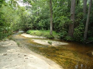
A new easement will protect land along the Enoree River in the rolling pastoral land of the South Carolina Piedmont. The easement directly adjoins a South Carolina Heritage Preserve that was established to protect a Federally-endangered species as well as other rare species and a wide variety of bird life. The state preserve is owned and managed by the South Carolina Department of Natural Resources for the benefit of the public. A portion of this property was purchased with the assistance of The Nature Conservancy and a 19.6-acre tract was acquired via mitigation by the SC Department of Transportation. It is frequently used for research projects by nearby Furman University faculty and students. Many members of the local community walk the trails. It appears that groups such as boy scouts and the Audubon Society are actively involved with the preserve. The Monastery for St. Clare of the Poor is across the road from the preserve and easement. This new easement not only enhances the regional scenic views but also the ecology of the area
. and without requiring state funding.
2.1.12 Press Release
 In the Georgia piedmont, three large tracts in proximity to each other were added, creating a total of 2611 protected acres. The easements include a variety of habitats such as Bottomland hardwood forests, pine plantations, Mixed mesic hardwood forests, Oak-hickory forests, cane breaks, Levee and Alluvial forests, open fields, wetlands, a large river, and creeks. One tract protects viewshed for Lake Russell. Another protects 8,000 ft. of frontage on the Broad River. In the Georgia piedmont, three large tracts in proximity to each other were added, creating a total of 2611 protected acres. The easements include a variety of habitats such as Bottomland hardwood forests, pine plantations, Mixed mesic hardwood forests, Oak-hickory forests, cane breaks, Levee and Alluvial forests, open fields, wetlands, a large river, and creeks. One tract protects viewshed for Lake Russell. Another protects 8,000 ft. of frontage on the Broad River.
One of the last free-flowing rivers in Georgia, the Broad flows into the Clarks Hill / Thurman Reservoir, which is important to the public as a drinking water source, for recreation, and as a regional amenity enhancing the quality of life. This water in turn flows into the Savannah River Basin which has been designated as a critical conservation area by a consortium of state and Federal agencies, conservation groups, and private landowners. It is part of the Federal Wild and Scenic Rivers System, plus the Georgia Department of Natural Resources has proposed that the Broad River be designated an environmental corridor. Recreational uses of the river include canoeing, kayaking, rafting, and fishing.
Prior to the 19th century, the Broad River in Georgia was the mutual border between the Cherokee people to the north, and the Creek people to the south. As a boy and young teen during the 1780s, the famous American explorer Meriwether Lewis of the Lewis & Clark Expedition honed his skills of exploration and wilderness survival, along with gaining first-hand knowledge about the native Americans Indians, while living beside the Broad River.
5.1.11 Press Release
The Southeast Regional Land Conservancy now protects a cumulative acreage of twelve thousand eight hundred ninety-eight (12,898) acres in a total of thirty-five projects (as of the end of 2011). Of the projects, six are in Alabama, fourteen in Georgia, eleven in North Carolina, three in South Carolina, and one in Tennessee.
The projects range from the mountains to the coast.
2.2.11 Press Release
 This past year the Southeast Regional Land Conservancy (https://serlc.org/) added a key jewel to its crown of protected land in the high mountains of the Southern Appalachians. Undisturbed forest habitat with so many Old Growth attributes is quite rare and restricted in our region due to the intensity of logging throughout history. In 2010 a tract with such grand forests was added to the protected lands within The Preserve at Little Pine in Madison County. This past year the Southeast Regional Land Conservancy (https://serlc.org/) added a key jewel to its crown of protected land in the high mountains of the Southern Appalachians. Undisturbed forest habitat with so many Old Growth attributes is quite rare and restricted in our region due to the intensity of logging throughout history. In 2010 a tract with such grand forests was added to the protected lands within The Preserve at Little Pine in Madison County.
 The 107-acre tract covers undulating mountainous coves and ridges. It became part of the extensive protected easement lands that now total one thousand two hundred twenty-one (1,221) acres…not a small amount for mountain land close to Asheville. Large, continuous blocks of land are crucial to population health of plant and animal species alike. Numerous rare plant species on the North Carolina Watchlist are present on the site. Many indicator species associated with the unusual circumneutral geologic conditions also thrive in the easement. These habitats are now protected for all future generations to come. The 107-acre tract covers undulating mountainous coves and ridges. It became part of the extensive protected easement lands that now total one thousand two hundred twenty-one (1,221) acres…not a small amount for mountain land close to Asheville. Large, continuous blocks of land are crucial to population health of plant and animal species alike. Numerous rare plant species on the North Carolina Watchlist are present on the site. Many indicator species associated with the unusual circumneutral geologic conditions also thrive in the easement. These habitats are now protected for all future generations to come.
1.29.11 Press Release
In 2010 the Southeast Regional Land Conservancy (https://serlc.org/) placed an easement protecting one thousand one hundred fifty-one (1,151) acres between Aiken, SC, and Augusta, GA. It is situated along in the northern edge of the Fall-line Sandhills which divide the Piedmont and Coastal Plain regions.
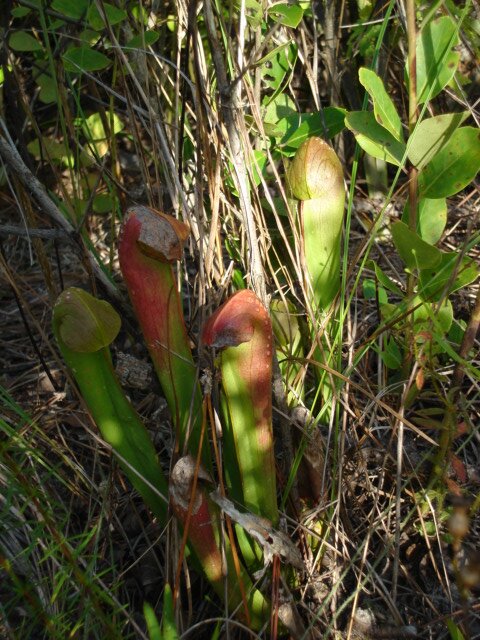
The easement is within an area identified by the State of South Carolina as high conservation priority for its Protection Strategy for Fall-line Sandhills Longleaf Pine Region. Longleaf pine savannahs are a rare natural community and the many of the few remaining examples are disappearing due to timbering and lack of fire. Mature longleaf pine habitat is especially valuable (due to the many rare species and biological diversity associated with this community type) and is given a protection priority by the state. The mature, open Pine Savannahs found on the property are highly significant. Some of the stands appear to be at least 75 years old.
The easement helps to protect land associated with rare species. The easement will protect habitat for which a historic population of the Federally endangered red-cockaded woodpecker used to be found. Good habitat still exists. The only way this endangered species can come back from near extinction is by having enough appropriate habitat such as that provided on the easement land. Eastern fox squirrels were noted during the survey. The easement will protect buffer land for rare species documented by the state, including bog spicebush, sweet pitcherplant, pyramid magnolia, piedmont water-milfoil, and nestronia. Based on the facts that the property contains listed species, as well as rich and diverse natural communities such as Bottomland Hardwood Forests & Pine Savannahs, the occurrence of other rare and uncommon animal and plant species is quite likely. Uncommon endemic (limited to a narrow global range) species such as wild rosemary are also found on the uncommon ‘sugar sands’ of the property.
The easement protects creek corridors, springs, and wetlands. The protection of the wetlands and tributaries provides public benefits that will be increasingly important in the future. These help to recharge ground water and maintain good water quality. The wetlands are also crucial for many plant species requiring wetland habitat, as well as animals such as crayfish and amphibians. The easement is adjacent to a protected county-owned wetland mitigation site, thus the connection adds ecological value to both sites. 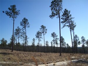
Many aspects of sound ecological management are already in place, which greatly enhances habitat quality for rare and common native species alike. This especially includes the prescribed burning so crucial to the Pine Savannahs and all the species depending upon them. This easement protects the clean water and significant natural communities for all generations to come.
2010 SERLC Summary
The Southeast Regional Land Conservancy protects a cumulative acreage of seven thousand nine hundred thirty-three (7,933) acres in a total of thirty-one projects. Of the projects, six are in Alabama, eleven in Georgia, eleven in North Carolina, two in South Carolina, and one in Tennessee. In 2010 we accepted a large new project in the South Carolina sandhills and added important habitat area to an existing easement in the North Carolina mountains. The one thousand three hundred and two (1,302) acres were placed under easement in 2010. Although projects range widely in sizes, the project size would average at 256 acres per project.
Easement land types have been divided into eleven classifications categories (see the pie chart). The classifications for the easements given from most to least prevalent are as follows: 1) Coastal forested land; 2) Mountain forested land; 3) Piedmont forested land; 4) Wetlands; 5) Piedmont open land; 6) Coastal open land; 7) Ridge and Valley forested land; 8) Stream corridor (actually a greater amount but often included within forested or open land); 9) Ridge and Valley open land; 10) Mountain open land; 11) Open water area is shown for a number of easements but is not counted as acreage. The main community types protected in the 2010 easements were Mountain forested land and Coastal forested land.
3.29.10 Whisper Mountain
When Bob and Meredith Stroud bought their twenty mountainside acres in WNC, they gave themselves a piece of heaven. When they placed a conservation easement on the land they gave a gift to the world. They became a part of protecting global biodiversity for everyone…forever. They chose land in Whisper Mountain, located on the Buncombe and Madison County lines northwest of Asheville.
 The Strouds and Troy Ball are friends from their days at Vanderbilt University. While catching up at their college reunion Troy mentioned that she and her husband, Charlie, were developing a mountain community near Asheville, NC; at the same time the Strouds said they were looking for mountain property in NC. The Balls were creating a unique environmentally ‘green’ community within the high mountains above the Sandy Mush community. As soon as the Stroudsvisited in 2006 they were convinced that they wanted to be a part of the Ball’s vision. The Strouds and Troy Ball are friends from their days at Vanderbilt University. While catching up at their college reunion Troy mentioned that she and her husband, Charlie, were developing a mountain community near Asheville, NC; at the same time the Strouds said they were looking for mountain property in NC. The Balls were creating a unique environmentally ‘green’ community within the high mountains above the Sandy Mush community. As soon as the Stroudsvisited in 2006 they were convinced that they wanted to be a part of the Ball’s vision.
The Balls, together with their family and friends have protected over 500 acres in Madison County through conservation easements through the Southern Appalachian Highlands Conservancy (SAHC; http://www.appalachian.org/). In 2009 SAHC teamed up with the Southeast Regional Land Conservancy (https://serlc.org/) to accomplish the Strouds’ conservation goal for the year. When ecologist Karin Heiman set foot on the tract she immediately noticed its diverse nature.
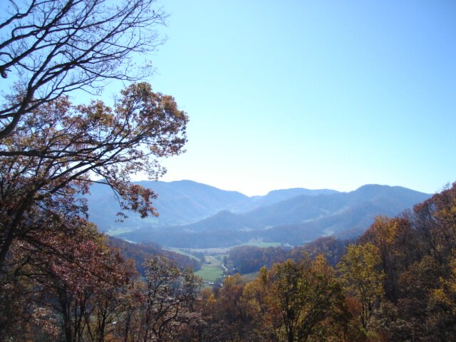
Although small in size, the Stroud’s land has many values. Continuity is an important ecological concept for sustainable habitat for plant and animal species. Habitat value is enhanced exponentially when connectivity occurs because habitat potential and diversity is increased. Whisper Mountain’s location is between the regionally significant Big Sandy Mush Valley and Pisgah National Forest. The Sandy Mush area has been the focus of conservation efforts supported by government funding for the last several years. Whisper Mountain is directly adjacent to currently protected Sandy Mush lands but not the National Forest, but does help to form a corridor of protected land between the two. This corridor will become increasingly important for wildlife migration and enhances ecological value of all the protected lands. The Stroud land will adjoin a future protected park, as well as being adjacent to other protected lands, within Whisper Mountain.
Looking back at early aerial photos of the Charlotte area drives home the point of the great importance at our present time to have forethought towards the future. Locations that were once wide-open greenspaces are now high-density urban areas, with the only greenspaces being enclosed in small parks and golf courses. Western North Carolina is undeniably under great development pressure. The ridgeline locations of the Stroud Tract forms part of the view seen from the Sandy Mush Valley. Every conserved tract gives the gift of enhancing scenic views sustaining the quality of life for people of the valley and the long-term economic tourism potential for the area.
The uncommon plant species hiding on the forest floor give away the rich soils and circumneutral geologic features. Potential habitat for rare species is easily found. Wildlife habitats stand out in the cavity trees and rock outcrops.
 Also, a surprising new contribution for the world is being shown where forests are allowed to remain without being cleared or logged, such as the Stroud’s tract. Forest loss and depletion accounts for 25% of worldwide CO 2 emissions, which are linked to global warming. Intact forests absorb CO2. Young forests provide a carbon gain of about 140 tons of carbon per acre (Wayburn, 2008). Conservation forests 200 years old provide a carbon gain of about 275 tons per acre. Also, a surprising new contribution for the world is being shown where forests are allowed to remain without being cleared or logged, such as the Stroud’s tract. Forest loss and depletion accounts for 25% of worldwide CO 2 emissions, which are linked to global warming. Intact forests absorb CO2. Young forests provide a carbon gain of about 140 tons of carbon per acre (Wayburn, 2008). Conservation forests 200 years old provide a carbon gain of about 275 tons per acre.
Thus the Strouds have accomplished protecting a gem for themselves and for the rest of the world, which others may wish to follow.
 1.27.10 Boone Creek 1.27.10 Boone Creek
New for 2009 is the Boone Creek conservation easement. It is a 233-acre site located between the Okeefenokee National Wildlife Refuge and the St. Mary’s River in the Georgia coastal plain. The land cover is composed of a matrix of pine plantations and wetlands, with Boone Creek flowing through one corner of the tract. Small amounts of Bottomland Hardwood forest are found along the fringes of some wetlands and in the creek corridor. The main wetland type present is the Cypress-Gum Swamp (also called Nonriverine Swamp Forest or Forested Depressional Wetland).
The state-listed hooded pitcher plant (Sarracenia minor) was found during the baseline survey. A second carnivorous plant, the sundew (Drosera sp.) was thriving near the pitcher plant population. At least one species of bog buttons (Lachnocaulon) was observed during the survey and could possibly be the rare southern bog button (Lachnocaulon beyrichianum). Many of the 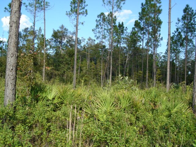 rare and uncommon plant species depend upon the open habitat on the fringes of the wetlands. If the maturing pines and the open understory of the pine forests are maintained, good potential red-cockaded woodpecker (Picoides borealis) habitat will also be provided. rare and uncommon plant species depend upon the open habitat on the fringes of the wetlands. If the maturing pines and the open understory of the pine forests are maintained, good potential red-cockaded woodpecker (Picoides borealis) habitat will also be provided.
The conservation tract enhances ecological attributes for the Federally protected Okeefenokee National Wildlife Refuge. The refuge has been protected as far back as 1937 and is part of a national system to protect wildlife and habitats for public benefit (Okeefenokee, 2009; Folkston, 2009). Designated as a National Wilderness Area in 1974, the Okeefenokee Swamp is recognized as a Wetland of International Importance. Although the easement does not border the Okeefenokee it provides proximal protected habitat for wildlife migration, population expansion, and a potential refuge area in the case of widespread, intense fire occurrences within the Okeefenokee Swamp.
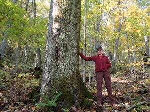
2.05.09 Family Pride
 |
|
Two generations (Trip Martin and son-in-law Rick Gammon) plan future care of the forest as they stand on an historic wagon road estimated to be over 150 years old. Next to them is a spring that had been used for one of the University research projects made possible by the owners.
|
Some years ago the Martin family joined with other families to protect a piece of Heaven in the North Georgia Mountains, complete with a clear rushing trout stream. In 2006 their dream of placing the land under permanent protection became a reality as they worked with Southeast Regional Land Conservancy. One of the biggest joys of land trust work can be going back each year for monitoring visits with owners who truly care about the land, as is the case each time we visit the Martins.
Stewards of the land, the Martins keep a close eye on the health of the hemlock trees, the water quality of the stream and springs, and the multitude of other land management concerns. With forethought in mind, they have been adding native trees and shrubs along the stream bank to protect the stability and temperature. Hopefully, before global warming has time to cause further increases in stream temperatures, the vegetation will be tall enough to help ameliorate some of the effects.
When they turned their efforts to revitalizing the small farmland acreage, they weren’t satisfied simply putting alpacas out to pasture. They created a plan beneficial to both the environment and education. Working with the local Natural Resource Conservation Service agency office, they gave protection never before given to the spring areas within the pasture. Aquatic features were fenced off from animals and native restoration species are being planted. The fence closest to the stream was moved 10 ft further from the banks for added protection. Native species have been planted there and a woodchip path now runs the perimeter to allow school children educational visits. But they didn’t stop there. When the compact barn was built for the animals, it was designed with facilities to allow observation of veterinary procedures and also but a room that will enable University students to spend two weeks at a time carrying out research.
1.31.09 New Land Protection for 2008
In 2008 the Southeast Regional Land Conservancy was pleased to double the number of acres under protection by adding four new projects totaling 3,492 acres. An additional 127 acres were also added to increase two existing projects. The projects are well-distributed across a variety of ecosystems, with one in the North Carolina Mountains, one in the Tennessee Ridge & Valley, one in the South Carolina Coastal Plain, one in the Georgia Piedmont, and one in the Georgia Coastal Plain. That brings SERLC’s total conservation land area to 6,254 acres.
 |
|
Cypress tree in a unique Carolina Bay
|
In the South Carolina Coastal Plain, a tract of 1,153 acres was placed under protection. The critical location is within both an area designated as part of the Savannah River Preserve and the South Lowcountry Focus Area (SOLO). SOLO was established to focus on habitat protection by the Atlantic Coast Joint Venture of the 1986 North American Waterfowl Management Plan (NAWMP), a cooperative effort between the United States, Canada and Mexico
The land is adjacent and proximal to thousands of acres of protected land and supports a variety of habitats including wetlands, bottomland hardwoods, uplands, working forests, Carolina Bays, aquatic features, small examples of Xeric Sandhill Scrub/Sand Barren Variant communities, and open fields. The Cypress Savannahs present in the Carolina Bays are considered globally rare. Mainly found in a small region centered around coastal South Carolina, the origin of Carolina Bays is still unclear to science. One theory postulates large meteorites impacting the earth. From aerial photographs, it can be noted that these numerous depressions are generally oval in shape and are oriented in the same general direction with the earth pushed up on one side. The depressions filled with water and became inhabited by wetland vegetation over time.
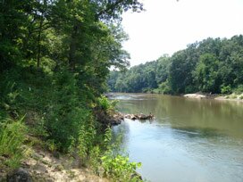
In the upper Coastal Plain of Georgia 1190 acres proximal to other protected lands were eased. The varied habitats include open fields, working pine forests, Bottomland Hardwoods, Cypress-Gum Swamps, wetlands, creeks, river bluff community, and river frontage. An interpretive natural area was established by previous owners, Union Camp, to showcase the significant natural features in the wetland areas. The property has a long frontage on the Oconee River and occurs within the Altamaha River Basin. The large Cotton House Slough runs through the property and is associated with many of the wetland communities.
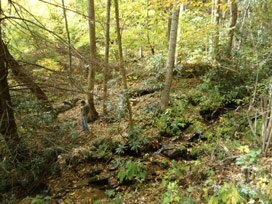
In the Tennessee Ridge and Valley, 104 acres were eased in a region where the value of conservation is being compellingly realized. The regional ridgelines are highly visible and form the views for the cities, roads, and valleys. However, they are being aggressively covered in high-density developments and the natural and scenic character of the area is being eroded quickly. Since it appears there is no “ridge law” is in effect (codes protecting public views by stating that structures must be built below the immediate ridgeline) conservation easements appear to be the best measure of protection. Included on the land are a mature Oak-hickory forest, Alluvial Forest, and a historic mill site.
In Georgia, 991 acres were protected along the transition edge between the Piedmont and Coastal Plain provinces. Along with working pine forests, at least 103 acres (US COE estimates) of wetlands are included. The land also directly helps to maintain scenic views from well-known US Highway 441.
In the North Carolina Mountains 73 acres were added to a spectacular preserve that now totals 964 acres (see also the press release on 12.01.08 on conservation communities). The overall preserve houses rare species, high quality natural communities, rock outcrops, and many other features. In Alabama, 54 acres that include wetlands, open water, and lake frontage were added to an existing project.
12.01.08 Environmental Recognition.
The Preserve at Little Pine in Madison County, North Carolina has been awarded "Most Environmentally Conscious Planned Community" and "Best Preserve" by Pinnacle Living Magazine in their 2008 Annual Guide/Best of Communities editions. SERLC is proud to be a partner in the conservation effort at Little Pine, holding nine hundred sixty-four (964) acres of preservation property in conservation easements and actively supporting the community’s management in environmental consultation.
07.26.08 Every day is different... Work has included sitting on top of mountains, getting dropped off on islands I’ve never seen, wading through crocodile waters in the dark with only a small flashlight, working in the desert (looking for lichens for anti-cancer research), crawling through mud in swamps with their vibrant, lush growth, being stranded on foreign islands and jungles, identifying old-growth forests for protection and speaking on ‘Good Morning America.’
Read More >>
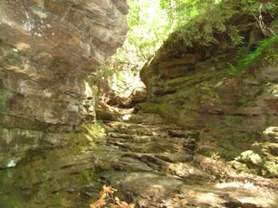
01.31.08. Unique projects of 2007. SERLC gave protection to ten new projects in 2007. Totaling 1,140 acres, the projects were wide and varied. Some of the highlights include rugged mountain lands with habitat for rare and watchlist species in North Carolina, a miniature gorge in the Alabama Ridge and Valley country, protection of trout stream and wildlife habitat in Georgia, and a unique development-reversal project for public benefit. Glimpses of these projects are given on the Press Release page.
 |
 |
|
Rugged mountain tract
|
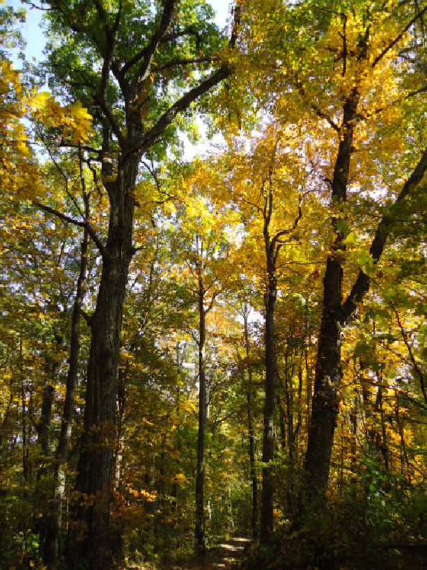
In North Carolina we were pleased to embrace adding an additional 448 acres of rugged mountain land onto previous easements which together protect 891 contiguous acres. The overall project takes in high mountain ridges, diverse coves, mountain views, mature forests, wetlands, streams, rare species, rare natural communities, and quality wildlife habitat.
SERLC also protected a small, forested mountain tract with rare species. An important facet of this tract is that it will help to preserve the ecology and scenic quality of the nationally recognized Blue Ridge Parkway and Mountains-to-the-Sea Trail corridors.
In the Alabama Ridge and Valley, a small project will protect ravines that include a miniature gorge with rock grottoes. Home to a fox den, bigleaf magnolia (whose leaves can reach up to three feet in length), and other relatively common species, the site also provides potential habitat for uncommon species of plants, animals, and bryophytes due to the especially humid conditions and rock exposures.
Also in Alabama, a unique project is taking place. While the current trend in the US is for golf courses and developments to displace natural habitats at a rapid rate, this project will create a reverse process. An existing old golf course will be transformed into an exemplary park to conserve natural features and provide the public with exercise walking trails.
“Development” of the site will include habitat enhancement to increase ecological values of the tract. There will be plantings of native species, stream bank stabilization, removal of invasive exotic species that threaten native diversity, establishment of grasslands, and protection of wetlands, wetland buffers, open areas, and forests. Wetlands are essential for ecological integrity and the quality of human life in that they provide public values such as groundwater recharge, habitat for associated species, habitat diversity, pollution abatement, and flood control.
 |
|
|
Alabama rock grotto
|
Stream restoration will reduce erosion, improve water quality, and enhance habitat. Since golf course maintenance chemicals are being discontinued, habitat quality for birds, macro-invertebrates, amphibians, reptiles, and other species will improve. Habitat for butterflies as well as other fauna and flora will also be enhanced as the open lands are restored to increase native flowering species.
The public walking trails will be situated near a proposed municipal area and should increase public awareness and accessibility for exercise health benefits. The site also supplies an excellent canvas upon which creation of restoration natural areas can be studied for future projects elsewhere.
Our Georgia news includes two new additions. A small mountain tract protects forests and a trout stream corridor that border National Forest lands. A piedmont tract will retain 200 acres of wildlife habitat in an area near recreational lakes which is rapidly changing to residential and 2nd home developments.
01.31.07. Wetlands protected. Thirty-six acres of important wetlands were protected in the rapidly developing Raleigh NC area. The wetland are contiguous with NC DOT wetland mitigation preservation sites. This will increase the ecological value of both areas in quantum measures. Wake County considers this portion of the watershed to be high profile and worthy of protection.
01.31.07. Environmental education center. Another portion of the Raleigh easement lands, which had been slated for high density development, will not only preserve forests buffering aquatic resources but will create a public greenspace with walking trails and an environmental education center.
|